When rockets blasted off the launch pads of Cape Canaveral Air Force Station in the USA, French Guiana in the Caribbeans or Baikonur Cosmodrome in Kazakhstan, the effort and relevance of such space missions were seen as affairs of the United States, European Union, Russia, or other developed countries.
However, in the late 21st century, when most countries started awakening to the realities of the benefits of space, the African continent was not left behind. This was due to the direct application of space technology and products to solve many problems bedevilling the African continent.
As part of the United Nations’ Sustainable Development Goal 2 (SDG 2), African countries are committed to the “Zero Poverty” agenda. Among other targets of SDG 2, ending all forms of hunger and malnutrition by 2030 is a priority. However, climate change poses a significant threat to achieving the goal, especially among African countries with dominant subsistence farming.
Luckily, the ease of accessibility of satellite data offers a promising solution to Africa’s agricultural sector. One of such satellite applications is the weather data provided by series of satellite missions such as the Geostationary Operational Environmental Satellite (GOES) operated by NASA, the National Oceanic and Atmospheric Administration (NOAA) and the European Organisation for the Exploitation of Meteorological Satellites (EUMETSAT), among others.
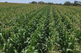
Satellites offer comprehensive coverage and accessible data relevant for accurate forecasting to protect farms from uncertain weather patterns. As is the case for most African farmers, reliance on natural weather patterns that influence crop growth, when to till the land, or even expect harvest is common.
However, with the impact of climate change already being felt, this is no longer the case. As a result, there are inconsistent rainfall patterns experienced in different regions. This inconsistency leads to losses in crop yields. In some cases, it results in novel pest and disease attacks in regions that have never experienced them before.
Despite these challenges, satellite products provide a solution to countering the effects of erratic weather patterns that may lead to drought and famine, which may, in turn, lower the crop yields in such regions. A 2020 Journal of Satellite Precipitation Measurement study in Rwanda established that satellite rainfall data is critical to accurately forecasting weather due to the limitation of ground in-situ rain gauge measuring instruments. Indeed this is not only Rwanda’s problem but also Sub-Saharan Africa’s.
Unlike ground measurements, satellites cover large areas and can access data over a region more than once a day, depending on the orbital orientation. With the existence of novel machines and deep learning techniques at our disposal, it is possible to numerically improve the prediction of weather patterns to a high degree of accuracy and reduce uncertainty among farmers.
- Chamisa under fire over US$120K donation
- Mavhunga puts DeMbare into Chibuku quarterfinals
- Pension funds bet on Cabora Bassa oilfields
- Councils defy govt fire tender directive
Keep Reading
This can tremendously improve agriculture to ensure that farmers know the right time to till, plant and harvest their crops. Additionally, radar satellites such as European Union’s SENTINEL series provide free and ready information about plant requirements such as soil moisture content. Decision-makers cannot ignore the valuable data provided by satellites across the globe to realise a “zero hunger” society as envisaged in UN’s SDG 2.
Contrary to the old thought that space and satellite technology was a “big boys club”, African countries and other developing countries stand a chance to benefit from satellite products in addressing challenges, as is the case with agriculture. – Space in Africa


